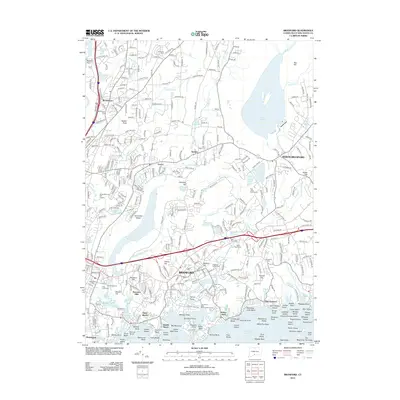
2012 Map of Branford
USGS Topo · Published 2012About this map
Lake Saltonstall and the sprawling Lake Gaillard anchor the landscape of south-central Connecticut, defining a region where coastal inlets meet inland ridges. The town of Branford serves as a central hub, surrounded by distinct neighborhoods and coastal settlements such as Pine Orchard, Indian Neck, and Short Beach. This coastal orientation is balanced by significant historical markers, including several burial grounds like Branford Center Cem and Damascus Cem, which offer essential data points for local genealogists.
Find a feature on this map
151 named features on this map. Tap any name to fly to it.
Don’t see what you’re looking for? This feature index may not catch every label — zoom into the map to look around manually.
Map Details
Editions of this 2012 Branford Map
This is the sole edition of this map. No revisions or reprints were ever made.
Other maps of this area

1892 · New Haven
USGS Topo · 1:62,500

1893 · Guilford
USGS Topo · 1:62,500

1921 · New Haven
USGS Topo · 1:62,500

1943 · Durham
USGS Topo · 1:25,000

1943 · New Haven
USGS Topo · 1:31,680

1947 · Hartford
USGS Topo · 1:250,000

1948 · Hartford
USGS Topo · 1:250,000
1951 · Woodmont
USGS Topo · 1:31,680

1953 · Durham
USGS Topo · 1:31,680

1954 · Guilford
USGS Topo · 1:31,680