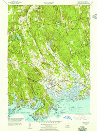
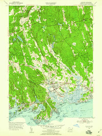
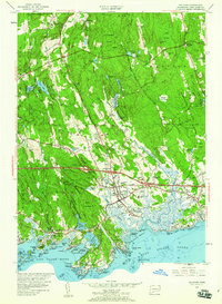
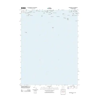
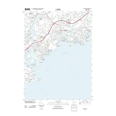
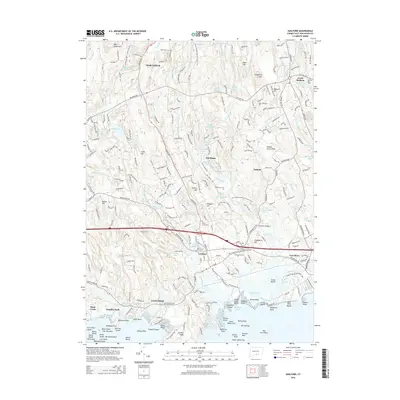
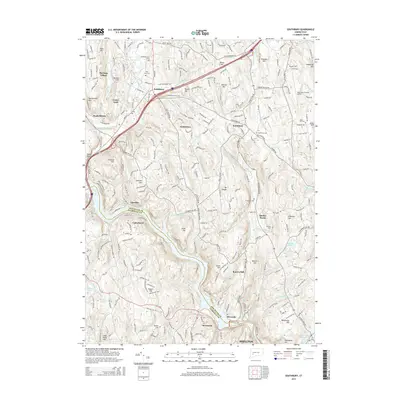
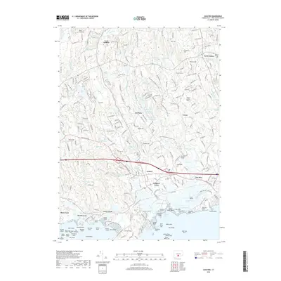
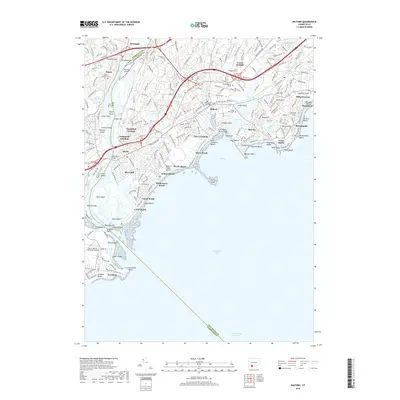
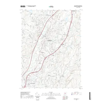
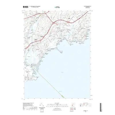
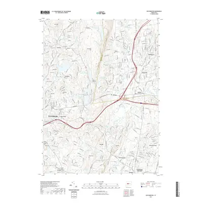
1954 Map of Guilford
USGS Topo · Published 1956About this map
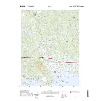
The Cockaponset State Forest dominates the inland landscape of this mid-century New Haven County survey, revealing a densely wooded upland transitioning toward the Long Island Sound shoreline. The village of Guilford serves as the central hub, where the New York New Haven and Hartford railroad cuts through the coastal marshes near the Guilford Sta. To the north, the terrain is defined by family-named landmarks like Melissa Jones Sch and the secluded Monastery near North Guilford.
Find a feature on this map
116 named features on this map. Tap any name to fly to it.
Don’t see what you’re looking for? This feature index may not catch every label — zoom into the map to look around manually.
Map Details
Editions of this 1954 Guilford Map
4 editions found
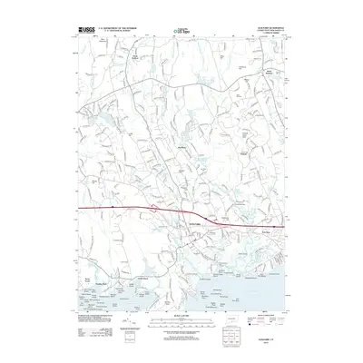
Historical Maps of Branford Through Time
67 maps found

1946 Southington
New Haven County, CT

1951 Milford
New Haven County, CT

1953 Southbury
New Haven County, CT

1954 Guilford
New Haven County, CT

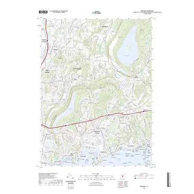
1954 Mount Carmel
New Haven County, CT

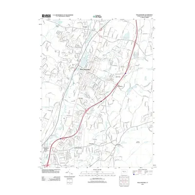
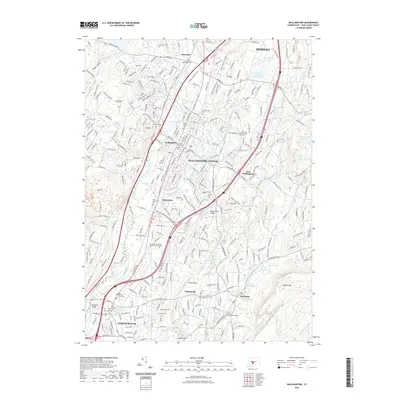
1954 Wallingford
New Haven County, CT

1955 Southington
New Haven County, CT

1960 Milford
New Haven County, CT

1964 Southbury
New Haven County, CT

1967 Mount Carmel
New Haven County, CT

1967 Wallingford
New Haven County, CT

1968 Guilford
New Haven County, CT

1968 Southington
New Haven County, CT

1984 Milford
New Haven County, CT
2012 Branford
New Haven County, CT
2012 Branford OE S
New Haven County, CT
2012 Clinton OE S
New Haven County, CT
2012 Guilford
New Haven County, CT
2012 Guilford OE S
New Haven County, CT
2012 Milford
New Haven County, CT
2012 Mount Carmel
New Haven County, CT
2012 Southbury
New Haven County, CT
2012 Southington
New Haven County, CT
2012 Wallingford
New Haven County, CT
2015 Branford
New Haven County, CT
2015 Branford OE S
New Haven County, CT
2015 Clinton OE S
New Haven County, CT
2015 Guilford
New Haven County, CT
2015 Guilford OE S
New Haven County, CT
2015 Milford
New Haven County, CT
2015 Mount Carmel
New Haven County, CT
2015 Southbury
New Haven County, CT
2015 Southington
New Haven County, CT
2015 Wallingford
New Haven County, CT
2018 Branford
New Haven County, CT
2018 Branford OE S
New Haven County, CT
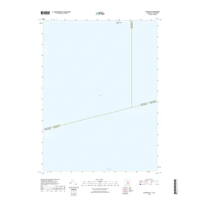
2018 Clinton OE S
New Haven County, CT
2018 Guilford
New Haven County, CT
2018 Guilford OE S
New Haven County, CT
2018 Milford
New Haven County, CT
2018 Mount Carmel
New Haven County, CT
2018 Southbury
New Haven County, CT
2018 Southington
New Haven County, CT
2018 Wallingford
New Haven County, CT
2021 Branford
New Haven County, CT
2021 Branford OE S
New Haven County, CT

2021 Clinton OE S
New Haven County, CT
2021 Guilford
New Haven County, CT
2021 Guilford OE S
New Haven County, CT
2021 Milford
New Haven County, CT
2021 Mount Carmel
New Haven County, CT
2021 Southbury
New Haven County, CT
2021 Southington
New Haven County, CT
2021 Wallingford
New Haven County, CT
2023 Branford
New Haven County, CT
2023 Branford OE S
New Haven County, CT
2023 Guilford
New Haven County, CT

2024 Branford
New Haven County, CT

2024 Branford OE S
New Haven County, CT

2024 Clinton OE S
New Haven County, CT

2024 Guilford
New Haven County, CT

2024 Guilford OE S
New Haven County, CT

2024 Milford
New Haven County, CT

2024 Mount Carmel
New Haven County, CT

2024 Southbury
New Haven County, CT

2024 Southington
New Haven County, CT

2024 Wallingford
New Haven County, CT