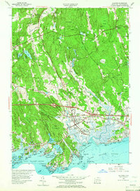
1954 Map of Guilford
USGS Topo · Published 1966About this map
The New York New Haven and Hartford railroad cuts a vital path across this coastal landscape, connecting the town center of Guilford with its outlying maritime settlements. This mid-century survey captures the shoreline before later development intensified, showing the intricate cluster of the Thimble Islands and the rocky points of Sachem Head and Leetes Island. Inland, the terrain is dominated by the sprawling Cockaponset State Forest, where elevations rise toward Cranberry Hill and Race Hill. The map documents a community in transition, balancing its agricultural roots in places like Nut Plains and North Guilford with the modern arrival of the Connecticut Turnpike. Local landmarks such as the Guilford Sta, Melissa Jones Sch, and the Monastery near North Madison provide specific touchpoints for genealogists tracing family history in the hills and harbors of southern New Haven County.
Find a feature on this map
101 named features on this map. Tap any name to fly to it.
Don’t see what you’re looking for? This feature index may not catch every label — zoom into the map to look around manually.
Map Details
Editions of this 1954 Guilford Map
4 editions found
Other maps of this area

1892 · New Haven
USGS Topo · 1:62,500

1893 · Guilford
USGS Topo · 1:62,500

1921 · New Haven
USGS Topo · 1:62,500

1943 · Durham
USGS Topo · 1:25,000

1947 · Hartford
USGS Topo · 1:250,000

1948 · Hartford
USGS Topo · 1:250,000

1951 · Clinton
USGS Topo · 1:31,680

1952 · Haddam
USGS Topo · 1:31,680

1953 · Durham
USGS Topo · 1:31,680

1954 · Guilford
USGS Topo · 1:31,680