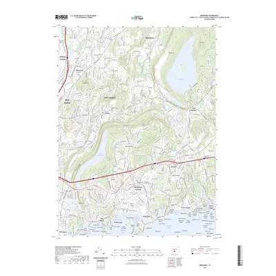
2023 Map of Branford
USGS Topo · Published 2023About this map
Branford Center and the surrounding coastline of Long Island Sound define this modern look at South Central Connecticut. The landscape is dominated by the massive water storage of Lake Gaillard to the northeast and the elongated Lake Saltonstall to the west, both buffered by the dramatic trap rock elevations of Metacomet Ridge and Saltonstall Ridge. These geological formations have historically constrained development, leaving large corridors of wooded terrain amidst the suburban expansion of East Haven and North Branford.
Find a feature on this map
145 named features on this map. Tap any name to fly to it.
Don’t see what you’re looking for? This feature index may not catch every label — zoom into the map to look around manually.
Map Details
Editions of this 2023 Branford Map
This is the sole edition of this map. No revisions or reprints were ever made.
Other maps of this area

1892 · New Haven
USGS Topo · 1:62,500

1893 · Guilford
USGS Topo · 1:62,500

1921 · New Haven
USGS Topo · 1:62,500

1943 · Durham
USGS Topo · 1:25,000

1943 · New Haven
USGS Topo · 1:31,680

1947 · Hartford
USGS Topo · 1:250,000

1948 · Hartford
USGS Topo · 1:250,000
1951 · Woodmont
USGS Topo · 1:31,680

1953 · Durham
USGS Topo · 1:31,680

1954 · Guilford
USGS Topo · 1:31,680