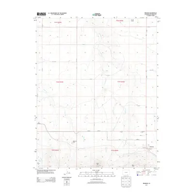
2013 Map of Branson
USGS Topo · Published 2013About this map
Branson anchors the southeastern corner of this Las Animas County survey, situated at a crossroad of local thoroughfares like William St and Branson St. The surrounding high plains and canyon country are defined by a network of seasonal watercourses and prominent geological landmarks. To the west, the striking profile of Watervale Butte rises above Doss Arroyo, while the southern landscape is marked by the distinct formations of Saddle Rock and Brown Mesa. This region, characterized by its ranching heritage and rural isolation, maintains its connection to the past through several remote burial grounds, including Cejita Cem, Mtn View Cem, and Romero Cem near Romero Spring. The drainage patterns of Trementina Creek and Alkali Arroyo carve through the northern sections of the quadrangle, illustrating the rugged hydrologic character of the Colorado-New Mexico borderlands.
Find a feature on this map
35 named features on this map. Tap any name to fly to it.
Don’t see what you’re looking for? This feature index may not catch every label — zoom into the map to look around manually.
Map Details
Editions of this 2013 Branson Map
This is the sole edition of this map. No revisions or reprints were ever made.
Other maps of this area

1891 · Mesa De Maya
USGS Topo · 1:125,000

1892 · Elmoro
USGS Topo · 1:125,000

1893 · Elmoro
USGS Topo · 1:125,000

1893 · Mesa de Maya
USGS Topo · 1:125,000

1897 · Elmoro
USGS Topo · 1:125,000

1954 · Raton
USGS Topo · 1:250,000

1954 · Trinidad
USGS Topo · 1:250,000

1954 · Dalhart
USGS Topo · 1:250,000

1955 · La Junta
USGS Topo · 1:250,000

1955 · Trinidad
USGS Topo · 1:250,000