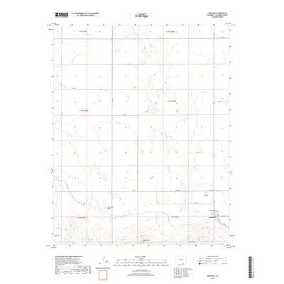
2019 Map of Branson
USGS Topo · Published 2019About this map
Branson anchors the southeastern corner of this landscape, where the high plains meet the intricate drainages of the Colorado-New Mexico border. The settlement's street grid, including William St and Athey, sits at the base of the prominent Saddle Rock formation. This 2019 survey documents a region defined by its verticality, from the flat expanse of Brown Mesa to the distinct summit of Watervale Butte. Water management in this arid environment is etched into the terrain through a network of seasonal washes such as Trementina Cr, Doss Arroyo, and Alkali Arroyo. For genealogists, the map is particularly valuable for its documentation of isolated burial sites, including Mountain View Cem and Cejita Cem north of the townsite, and Romero Cem located near the headwaters of Chaney Arroyo and the secluded Romero Spring.
Find a feature on this map
37 named features on this map. Tap any name to fly to it.
Don’t see what you’re looking for? This feature index may not catch every label — zoom into the map to look around manually.
Map Details
Editions of this 2019 Branson Map
This is the sole edition of this map. No revisions or reprints were ever made.
Other maps of this area

1891 · Mesa De Maya
USGS Topo · 1:125,000

1892 · Elmoro
USGS Topo · 1:125,000

1893 · Elmoro
USGS Topo · 1:125,000

1893 · Mesa de Maya
USGS Topo · 1:125,000

1897 · Elmoro
USGS Topo · 1:125,000

1954 · Raton
USGS Topo · 1:250,000

1954 · Trinidad
USGS Topo · 1:250,000

1954 · Dalhart
USGS Topo · 1:250,000

1955 · La Junta
USGS Topo · 1:250,000

1955 · Trinidad
USGS Topo · 1:250,000