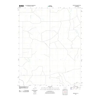
2010 Map of Branson SE
USGS Topo · Published 2010About this map
Bachicha Creek and Chacuaco Creek wind through this remote corner of Las Animas County, carving paths through the high plains landscape near the New Mexico border. The area is defined by its drainage systems and the southern reach of Long Canyon, which cuts across the southeastern portion of the quadrangle. A sparse network of rural routes, including County Rd 147 and County Rd 143, provides the primary infrastructure for this ranching and grazing land. The map illustrates the late-twentieth-century development of the local transportation grid, where roads like County Rd 145.9 and County Rd 10.0 connect isolated points across the arid terrain.
Find a feature on this map
8 named features on this map. Tap any name to fly to it.
Don’t see what you’re looking for? This feature index may not catch every label — zoom into the map to look around manually.
Map Details
Editions of this 2010 Branson SE Map
This is the sole edition of this map. No revisions or reprints were ever made.
Other maps of this area

1891 · Mesa De Maya
USGS Topo · 1:125,000

1893 · Mesa de Maya
USGS Topo · 1:125,000

1954 · Dalhart
USGS Topo · 1:250,000

1955 · La Junta
USGS Topo · 1:250,000

1958 · La Junta
USGS Topo · 1:250,000

1958 · Dalhart
USGS Topo · 1:250,000

1962 · Dalhart
USGS Topo · 1:250,000

1968 · La Junta
USGS Topo · 1:250,000
1972 · Branson SE
USGS Topo · 1:24,000

1972 · Emery Peak
USGS Topo · 1:24,000