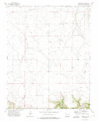
1972 Map of Branson SE
USGS Topo · Published 1975About this map
Bachicha Creek and Chacuaco Creek define the drainage of this High Plains landscape in southeastern Las Animas County during the early 1970s. The terrain is characterized by the winding paths of Negro Canyon and Long Canyon to the south, where the topography breaks into more complex formations. Evidence of early transit and transport infrastructure is visible through the historic Fort Union Road, which cuts diagonally across the central sections, and the Colorado and Southern railroad tracks that skirt the southwestern corner. This area, largely defined by its open ranchland and intermittent waterways, also shows localized industry at a Gravel Pit near the rail line. The map captures a moment when traditional travel routes and modern rail corridors intersected in this sparsely settled portion of Colorado.
Find a feature on this map
7 named features on this map. Tap any name to fly to it.
Don’t see what you’re looking for? This feature index may not catch every label — zoom into the map to look around manually.
Map Details
Editions of this 1972 Branson SE Map
This is the sole edition of this map. No revisions or reprints were ever made.
Other maps of this area

1891 · Mesa De Maya
USGS Topo · 1:125,000

1893 · Mesa de Maya
USGS Topo · 1:125,000

1954 · Dalhart
USGS Topo · 1:250,000

1955 · La Junta
USGS Topo · 1:250,000

1958 · La Junta
USGS Topo · 1:250,000

1958 · Dalhart
USGS Topo · 1:250,000

1962 · Dalhart
USGS Topo · 1:250,000

1968 · La Junta
USGS Topo · 1:250,000

1972 · Emery Peak
USGS Topo · 1:24,000

1972 · Miners Peak
USGS Topo · 1:24,000