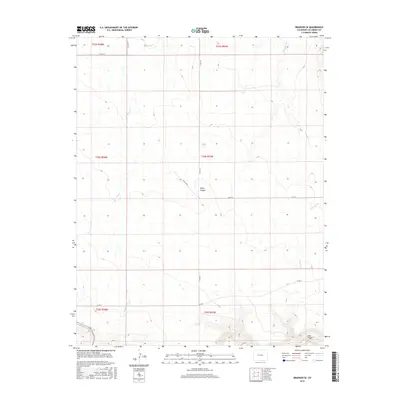
2016 Map of Branson SE
USGS Topo · Published 2016About this map
Bachicha Cr and Chacuaco Cr carve their way through this section of Las Animas County, shaping a landscape defined by deep erosional features like Negro Canyon and Long Canyon. This 2016 survey shows a territory where the Public Land Survey System grid remains the primary organizing force, visible through the township and range lines of t34s r57w and its neighbors. The area is marked by a sparse but essential network of county routes, including Co Rd 143 and Co Rd 147, which follow the contours of the high plains. The transition from the open flats to the dramatic relief of the southeastern canyons highlights the geological character of the Colorado borderlands, providing a clear record of the modern road placements and watercourses that sustain this ranching country.
Find a feature on this map
16 named features on this map. Tap any name to fly to it.
Don’t see what you’re looking for? This feature index may not catch every label — zoom into the map to look around manually.
Map Details
Editions of this 2016 Branson SE Map
This is the sole edition of this map. No revisions or reprints were ever made.
Other maps of this area

1891 · Mesa De Maya
USGS Topo · 1:125,000

1893 · Mesa de Maya
USGS Topo · 1:125,000

1954 · Dalhart
USGS Topo · 1:250,000

1955 · La Junta
USGS Topo · 1:250,000

1958 · La Junta
USGS Topo · 1:250,000

1958 · Dalhart
USGS Topo · 1:250,000

1962 · Dalhart
USGS Topo · 1:250,000

1968 · La Junta
USGS Topo · 1:250,000
1972 · Branson SE
USGS Topo · 1:24,000

1972 · Emery Peak
USGS Topo · 1:24,000