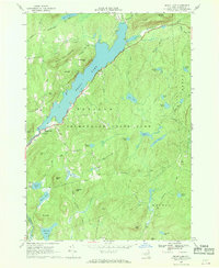
1966 Map of Brant Lake
USGS Topo · Published 1969About this map
The waters of Brant Lake dominate this mid-century survey of the eastern Adirondacks, where the settlement of Brant Lake and the small hamlet of Grassville sit along the southwestern shore. Situated within the Adirondack State Park, the terrain is defined by a dense network of peaks including Prickly Ash Mountain, Sand Beach Mtn, and Bartonville Mtn. Evidence of local industry appears near the main settlement in the form of a Sandpit and Gravel Pit, while narrow roads like Haysburg Road and Padanarum Road wind through the township boundaries of Horicon, Hague, and Bolton. Numerous smaller water bodies like Crystal Lake, Lily Pond, and Bennett Pond are tucked between the ridges, illustrating the complex drainage of the Lake George watershed before extensive modern development. Genealogists may note the small Cem located in the eastern portion of the quadrangle near Indian Pond.
Find a feature on this map
59 named features on this map. Tap any name to fly to it.
Don’t see what you’re looking for? This feature index may not catch every label — zoom into the map to look around manually.
Map Details
Editions of this 1966 Brant Lake Map
This is the sole edition of this map. No revisions or reprints were ever made.
Other maps of this area

1895 · North Creek
USGS Topo · 1:62,500

1895 · Paradox Lake
USGS Topo · 1:62,500

1897 · Bolton
USGS Topo · 1:62,500

1897 · Paradox Lake
USGS Topo · 1:62,500

1897 · North Creek
USGS Topo · 1:62,500

1897 · Schroon Lake
USGS Topo · 1:62,500

1900 · Bolton
USGS Topo · 1:62,500

1950 · Glens Falls
USGS Topo · 1:250,000
1953 · Paradox Lake
USGS Topo · 1:62,500

1953 · Schroon Lake
USGS Topo · 1:62,500