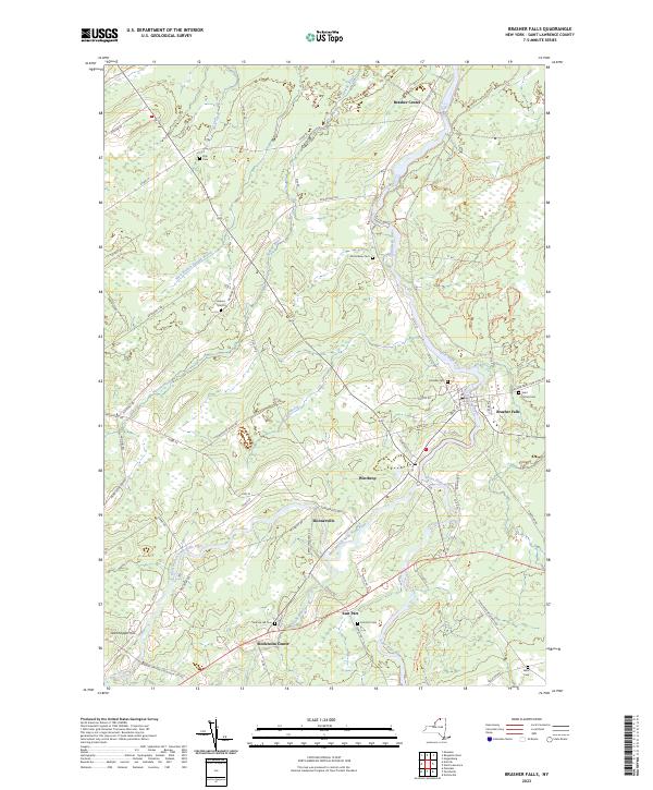
2023 Map of Brasher Falls
USGS Topo · Published 2023About this map
Saint Regis River and its western branch carve through the heart of this Saint Lawrence County landscape, defining the layout of the neighboring hamlets of Brasher Falls and Winthrop. This modern survey illustrates a well-connected rural corridor where long-established settlements like Skinnerville, Stockholm Center, and East Part are linked by a network of county roads and historic lanes. The distribution of family and community burial grounds, such as Saint Patrick Cem, Fairview Cem, and the remote Kyle Cem to the north, provides essential touchstones for genealogical research in this portion of the North Country.
Find a feature on this map
80 named features on this map. Tap any name to fly to it.
Don’t see what you’re looking for? This feature index may not catch every label — zoom into the map to look around manually.
Map Details
Editions of this 2023 Brasher Falls Map
This is the sole edition of this map. No revisions or reprints were ever made.
Other maps of this area

1906 · Massena
USGS Topo · 1:62,500

1907 · Massena
USGS Topo · 1:62,500

1908 · Potsdam
USGS Topo · 1:62,500

1915 · Moira
USGS Topo · 1:62,500

1917 · Moira
USGS Topo · 1:62,500

1919 · Nicholville
USGS Topo · 1:62,500

1921 · Nicholville
USGS Topo · 1:62,500

1942 · Norfolk
USGS Topo · 1:24,000

1942 · Massena
USGS Topo · 1:24,000

1943 · Potsdam
USGS Topo · 1:31,680