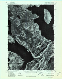
1977 Map of Brassua Lake East
USGS Topo · Published 1981About this map
Rockwood sits at the vital junction of the Moose River and the western shore of Moosehead Lake, serving as a central hub in this late 1970s orthophoto survey. The imagery reveals the intricate waterway connections of the Maine North Woods, where the river flows from Brassua Lake toward the larger expanse of Moosehead. To the north, Tomhegan Stream and Baker Pond break up the dense forest canopy, while the prominent Blue Ridge rises to the south. The presence of Farm Island offshore provides a clear look at the area's largest lake features before the West Outlet drains toward the Kennebec. This aerial perspective is particularly valuable for seeing the exact vegetation patterns and the modest footprint of human settlement in the Somerset County wilderness during this era.
Find a feature on this map
9 named features on this map. Tap any name to fly to it.
Don’t see what you’re looking for? This feature index may not catch every label — zoom into the map to look around manually.
Map Details
Editions of this 1977 Brassua Lake East Map
This is the sole edition of this map. No revisions or reprints were ever made.
Other maps of this area

1920 · Moosehead Lake
USGS Topo · 1:62,500

1921 · Brassua Lake
USGS Topo · 1:62,500

1922 · Moosehead Lake
USGS Topo · 1:62,500

1923 · Brassua Lake
USGS Topo · 1:62,500

1930 · Moosehead Lake
USGS Topo · 1:62,500

1944 · Brassua Lake
USGS Topo · 1:62,500

1944 · Moosehead Lake
USGS Topo · 1:62,500

1954 · Seboomook Lake
USGS Topo · 1:62,500

1954 · North East Carry
USGS Topo · 1:62,500

1954 · Millinocket
USGS Topo · 1:250,000
Featured Places
- Tomhegan Township, ME
- Sandwich Academy Grant Township, ME
- Kineo Township, ME
- Rockwood Strip T1 R1 NBKP, ME
- Taunton & Raynham Academy Grant, ME