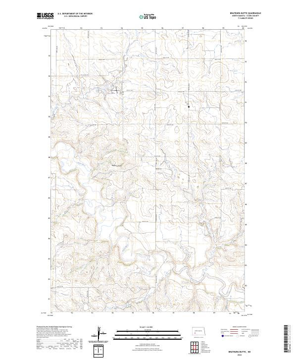
2024 Map of Bratburg Butte
USGS Topo · Published 2024About this map
Bratburg Butte rises as a prominent landmark in this section of Stark County, overlooking a landscape defined by the winding course of the Heart River. The river cuts through the southern half of the quadrangle, while Beaver Creek meanders through the northwest, illustrating the drainage patterns that have shaped the ranching and agricultural potential of the region for generations. The section lines are clearly marked by a rigid grid of rural roads like 97th Ave SW and 40th St Sw, which facilitate movement across the prairie. Historical markers of the community include the Pioneer Cem situated near the intersection of 93rd Ave SW and 39th St SW, providing a specific point of interest for genealogists tracing early prairie families. The presence of Brands Airport along 95th Ave SW further demonstrates the transition from traditional land use to modern utility in this rural North Dakota landscape.
Find a feature on this map
24 named features on this map. Tap any name to fly to it.
Don’t see what you’re looking for? This feature index may not catch every label — zoom into the map to look around manually.
Map Details
Editions of this 2024 Bratburg Butte Map
This is the sole edition of this map. No revisions or reprints were ever made.
Other maps of this area

1953 · Dickinson
USGS Topo · 1:250,000

1957 · Dickinson
USGS Topo · 1:250,000

1960 · White Butte NW
USGS Topo · 1:24,000

1960 · White Butte NE
USGS Topo · 1:24,000

1973 · Bratburg Butte
USGS Topo · 1:24,000

1973 · Boyle
USGS Topo · 1:24,000

1973 · Taylor
USGS Topo · 1:24,000

1973 · Lefor
USGS Topo · 1:24,000

1973 · Richardton SE
USGS Topo · 1:24,000

1973 · Gladstone
USGS Topo · 1:24,000