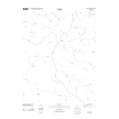
2013 Map of Breeding
USGS Topo · Published 2013About this map
Breeding serves as the central hub for this portion of Metcalfe County, situated at the intersection of several local routes in a landscape defined by sharp ridges and winding creeks. The terrain is characterized by prominent elevations such as Schemerhorn Ridge and Traylor Ridge, which divide the watersheds of Big Renox Cr and W Fork Crocus Cr. Small settlements like Toria and Cofer are linked by a network of family-named roads, including Chess Jessie Rd and Ross Curry Rd, reflecting a long history of local land ownership. Genealogists will find several burial sites preserved on the landscape, including Jessee Cem, Janes Cem, and Fudge Cem. The map illustrates the persistent rural character of south-central Kentucky, where the road network closely follows the natural contours of the ridges and the paths of waterways like Harrods Fork.
Find a feature on this map
90 named features on this map. Tap any name to fly to it.
Don’t see what you’re looking for? This feature index may not catch every label — zoom into the map to look around manually.
Map Details
Editions of this 2013 Breeding Map
This is the sole edition of this map. No revisions or reprints were ever made.
Other maps of this area

1953 · Gradyville
USGS Topo · 1:24,000

1953 · Breeding
USGS Topo · 1:24,000

1953 · Waterview
USGS Topo · 1:24,000

1953 · Edmonton
USGS Topo · 1:24,000

1953 · Amandaville
USGS Topo · 1:24,000

1953 · Burkesville
USGS Topo · 1:24,000

1953 · Dubre
USGS Topo · 1:24,000

1953 · East Fork
USGS Topo · 1:24,000

1954 · Columbia
USGS Topo · 1:24,000

1956 · Corbin
USGS Topo · 1:250,000