
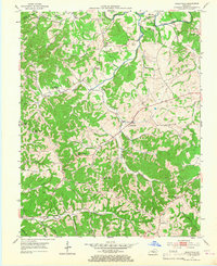
1953 Map of Gradyville
USGS Topo · Published 1954About this map
Gradyville serves as a central hub for this rural Kentucky landscape, where the Big Creek and Russell Creek drainages shape the settlement patterns of Adair County. The 1950s terrain is characterized by a high density of rural schoolhouses and community churches, many of which served dispersed farming families. Distinctive landmarks such as Tarters Chapel and Union Ch are situated alongside numerous local schools like West Big Creek Sch and Milltown Sch.
Find a feature on this map
49 named features on this map. Tap any name to fly to it.
Don’t see what you’re looking for? This feature index may not catch every label — zoom into the map to look around manually.
Map Details
Editions of this 1953 Gradyville Map
2 editions found
Other maps of this area

1953 · Breeding
USGS Topo · 1:24,000

1953 · Edmonton
USGS Topo · 1:24,000

1953 · Amandaville
USGS Topo · 1:24,000

1953 · Exie
USGS Topo · 1:24,000

1953 · Gresham
USGS Topo · 1:24,000

1953 · East Fork
USGS Topo · 1:24,000

1953 · Cane Valley
USGS Topo · 1:24,000

1954 · Columbia
USGS Topo · 1:24,000

1956 · Corbin
USGS Topo · 1:250,000

1957 · Winchester
USGS Topo · 1:250,000