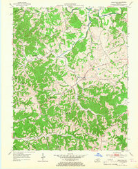
1953 Map of Gradyville
USGS Topo · Published 1967About this map
Gradyville serves as the central hub for this rural Kentucky landscape during the early 1950s, a region defined by a high density of small-scale community landmarks. The settlement pattern reveals an era of localized education and worship, with numerous institutions like Maple Grove Sch, Cool Springs Sch, and Tarters Chapel spaced within walking or horse-riding distance for the surrounding families. This topography is heavily carved by the winding course of Russell Creek and its many tributaries, such as Big Creek and Leatherwood Creek, which dictated the placement of homesteads and early road networks.
Find a feature on this map
45 named features on this map. Tap any name to fly to it.
Don’t see what you’re looking for? This feature index may not catch every label — zoom into the map to look around manually.
Map Details
Editions of this 1953 Gradyville Map
2 editions found
Other maps of this area

1953 · Gradyville
USGS Topo · 1:24,000

1953 · Breeding
USGS Topo · 1:24,000

1953 · Edmonton
USGS Topo · 1:24,000

1953 · Amandaville
USGS Topo · 1:24,000

1953 · Exie
USGS Topo · 1:24,000

1953 · Gresham
USGS Topo · 1:24,000

1953 · East Fork
USGS Topo · 1:24,000

1953 · Cane Valley
USGS Topo · 1:24,000

1954 · Columbia
USGS Topo · 1:24,000

1956 · Corbin
USGS Topo · 1:250,000