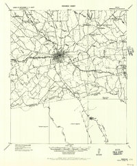
1956 Map of Brenham
USGS Topo · Published 1956About this map
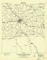
The railroad crossroads at Brenham serve as the focal point for this 1919 tactical survey, reprinted for civil use in the mid-1950s. The landscape is defined by the intersection of the Gulf Colorado and Santa Fe Railway and the Texas and New Orleans Railroad, which facilitated the growth of rural communities like Berlin, Zionsville, and Chapel Hill. Outside these hubs, the map reveals a dense network of local institutions essential to early 20th-century Texas life, including the Harrison Spring School, Polaski School, and Salem Church. The survey captures the transition from Washington County into Austin County at the southern edge, noting family-centric landmarks and service locations such as the County Farm and several post offices. Terrain features like New Year Creek and Sandy Creek dominate the drainage patterns, illustrating the rural agricultural character of the region before modern highway expansion.
Find a feature on this map
55 named features on this map. Tap any name to fly to it.
Don’t see what you’re looking for? This feature index may not catch every label — zoom into the map to look around manually.
Map Details
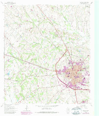
Editions of this 1956 Brenham Map
This is the sole edition of this map. No revisions or reprints were ever made.
Historical Maps of Brenham Through Time
9 maps found