
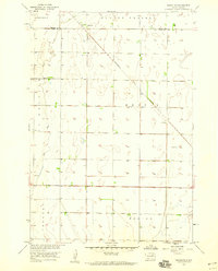
1953 Map of Brentford
USGS Topo · Published 1955About this map
Brentford sits at the heart of this mid-century survey, surrounded by the wide-open prairie of Spink and Brown counties. The landscape is defined by the slow-moving James River and the meandering path of Mud Creek, which cuts through the townships of Rondell and La Prairie. This era represents a time of transition in rural South Dakota, as evidenced by the marking of School No 1 and School No 3, signaling the consolidation of rural school districts that once dotted every few sections of the plains. For genealogists, the map provides a precise location for Plainview Cem and a small Landing Field near the town site, while the southern reaches of the quadrangle follow the intermittent drainage of Dry Run through Tetonka township.
Find a feature on this map
12 named features on this map. Tap any name to fly to it.
Don’t see what you’re looking for? This feature index may not catch every label — zoom into the map to look around manually.
Map Details
Editions of this 1953 Brentford Map
This is the sole edition of this map. No revisions or reprints were ever made.
Other maps of this area

1894 · Conde
USGS Topo · 1:62,500

1895 · Aberdeen
USGS Topo · 1:125,000

1953 · Stratford
USGS Topo · 1:24,000

1953 · Groton SW
USGS Topo · 1:24,000

1953 · Gallup
USGS Topo · 1:24,000

1953 · Warner
USGS Topo · 1:24,000

1954 · Mellette
USGS Topo · 1:24,000

1954 · Aberdeen
USGS Topo · 1:250,000

1956 · Aberdeen
USGS Topo · 1:250,000
1958 · Randolph
USGS Topo · 1:24,000
Featured Places
- Brentford, SD
- Tetonka Township, SD
- East Rondell Township, SD
- La Prairie Township, SD
- West Rondell Township, SD