
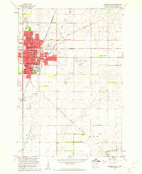
1953 Map of Warner
USGS Topo · Published 1955About this map
Warner stands as the primary settlement on this Brown County landscape, surveyed in the early 1950s as part of a Department of the Interior program for the development of the Missouri River Basin. The area is defined by a dense network of country schools, documenting the educational geography of the rural Warner and Rondell townships. These include Sunshine Sch, Happy Valley Sch, and Bright Star Sch, alongside others already noted as Sunshine Sch (Abandoned) and Saul Sch (Abandoned). The Chicago Milwaukee St Paul and Pacific railroad runs north-south through the terrain, paralleling the winding course of Moccasin Creek. This survey captures a moment when local water management was significant, evidenced by the presence of multiple Flowing Well sites across the prairie.
Find a feature on this map
11 named features on this map. Tap any name to fly to it.
Don’t see what you’re looking for? This feature index may not catch every label — zoom into the map to look around manually.
Map Details
Editions of this 1953 Warner Map
This is the sole edition of this map. No revisions or reprints were ever made.
Other maps of this area

1895 · Aberdeen
USGS Topo · 1:125,000

1899 · Northville
USGS Topo · 1:125,000

1953 · Brentford
USGS Topo · 1:24,000

1953 · Stratford
USGS Topo · 1:24,000

1954 · Bath
USGS Topo · 1:24,000

1954 · Mellette
USGS Topo · 1:24,000

1954 · Aberdeen
USGS Topo · 1:250,000

1956 · Aberdeen
USGS Topo · 1:250,000
1960 · Aberdeen East
USGS Topo · 1:24,000

1960 · Aberdeen West
USGS Topo · 1:24,000