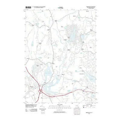
2010 Map of Brewster
USGS Topo · Published 2010About this map
The East Branch Reservoir and Bog Brook Reservoir dominate the southern landscape of this 2010 survey, illustrating the complex water management system essential to the region's development. Centered on the village of Brewster, the map shows a densely packed network of residential and commercial growth, particularly around Putnam Lake and the various "Corners" that define local neighborhoods such as Haines Corners and Sears Corners. The presence of the Milltown Cemetery and The Educational Alliance Camp provides specific points of interest for genealogists and local historians tracking community institutions. To the east, the terrain transitions into the highlands of Brimstone Mountain and Titicus Mountain, while the settlement of Mill Plain marks the approach toward the Connecticut border. This map documents a modern suburban-rural balance where large-scale reservoirs and infrastructure exist alongside smaller water bodies like Ball Pond and Lake Tonetta.
Find a feature on this map
108 named features on this map. Tap any name to fly to it.
Don’t see what you’re looking for? This feature index may not catch every label — zoom into the map to look around manually.
Map Details
Editions of this 2010 Brewster Map
This is the sole edition of this map. No revisions or reprints were ever made.
Other maps of this area

1892 · Danbury
USGS Topo · 1:62,500

1892 · New Milford
USGS Topo · 1:62,500

1892 · Carmel
USGS Topo · 1:62,500

1893 · Carmel
USGS Topo · 1:62,500

1893 · New Milford
USGS Topo · 1:62,500

1893 · Clove
USGS Topo · 1:62,500

1894 · Clove
USGS Topo · 1:62,500

1894 · Carmel
USGS Topo · 1:62,500

1898 · Clove
USGS Topo · 1:62,500

1901 · Clove
USGS Topo · 1:62,500