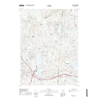
2019 Map of Brewster
USGS Topo · Published 2019About this map
The state line between New York and Connecticut bisects this landscape, separating the village of Brewster from the western outskirts of Danbury. The region is defined by a series of north-south reservoirs and ponds, including the Bog Brook Reservoir and the East Branch Reservoir, which were developed to manage the waters of the East Branch Croton River. These water bodies are flanked by significant elevations such as Cornwall Hill and Browns Mtn.
Find a feature on this map
253 named features on this map. Tap any name to fly to it.
Don’t see what you’re looking for? This feature index may not catch every label — zoom into the map to look around manually.
Map Details
Editions of this 2019 Brewster Map
This is the sole edition of this map. No revisions or reprints were ever made.
Other maps of this area

1892 · Danbury
USGS Topo · 1:62,500

1892 · New Milford
USGS Topo · 1:62,500

1892 · Carmel
USGS Topo · 1:62,500

1893 · Carmel
USGS Topo · 1:62,500

1893 · New Milford
USGS Topo · 1:62,500

1893 · Clove
USGS Topo · 1:62,500

1894 · Clove
USGS Topo · 1:62,500

1894 · Carmel
USGS Topo · 1:62,500

1898 · Clove
USGS Topo · 1:62,500

1901 · Clove
USGS Topo · 1:62,500