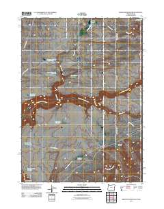
2011 Map of Brewster Reservoir
USGS Topo · Published 2011About this map
Brewster Ranch and Circle Bar Ranch anchor this high-desert ranching landscape in Malheur County, where water management is the primary driver of human geography. A complex network of catchments, including Brewster Reservoir Number Two, Cherry Creek Reservoir, and Mule Lake Reservoir, illustrates the efforts to harness seasonal runoff in an arid environment. The North Fork Owyhee River cuts through the central portion of the map, joined by tributaries such as Cherry Creek and Squaw Creek. Transportation is defined by functional ranching routes like Fenwick Ranch Rd and Parker Reservoir Rd. In the south, the topography drops into Little Box Canyon and Cougar Canyon, where Soldier Meadows Creek drains toward the Soldier Meadows area, indicating a reliance on natural meadows for grazing.
Find a feature on this map
21 named features on this map. Tap any name to fly to it.
Don’t see what you’re looking for? This feature index may not catch every label — zoom into the map to look around manually.
Map Details
Editions of this 2011 Brewster Reservoir Map
This is the sole edition of this map. No revisions or reprints were ever made.
Other maps of this area

1955 · Jordan Valley
USGS Topo · 1:250,000

1957 · Jordan Valley
USGS Topo · 1:250,000

1958 · Jordan Valley
USGS Topo · 1:250,000

1973 · Bedstead Ridge
USGS Topo · 1:24,000

1973 · Fairylawn
USGS Topo · 1:24,000

1973 · Cliffs
USGS Topo · 1:24,000

1980 · Brewster Reservoir
USGS Topo · 1:24,000

1980 · Three Forks
USGS Topo · 1:24,000

1980 · Juniper Point
USGS Topo · 1:24,000
1980 · Whitehorse Butte
USGS Topo · 1:24,000