
1980 Map of Three Forks
USGS Topo · Published 1980About this map
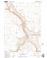
The Owhyee River carves a deep path through Malheur County, meeting its major tributaries at a remote hydrological junction in the high desert. This 1980 survey reveals the confluence of the North Fork Owyhee River and Middle Fork Owyhee River, a location marked by the prominent Three Forks Dome. The landscape is defined by sheer verticality and the isolation of the Owhyee Canyon, where human presence is recorded primarily through specialized infrastructure like the Wes Hawkins Trail (Pack) and the Military Grade road.
Find a feature on this map
34 named features on this map. Tap any name to fly to it.
Don’t see what you’re looking for? This feature index may not catch every label — zoom into the map to look around manually.
Map Details
Editions of this 1980 Three Forks Map
2 editions found
Other maps of this area

1955 · Jordan Valley
USGS Topo · 1:250,000

1957 · Jordan Valley
USGS Topo · 1:250,000

1958 · Jordan Valley
USGS Topo · 1:250,000

1980 · Brewster Reservoir
USGS Topo · 1:24,000
1980 · Skull Creek
USGS Topo · 1:24,000

1980 · Juniper Point
USGS Topo · 1:24,000
1980 · Squaw Flat
USGS Topo · 1:24,000
1980 · Whitehorse Butte
USGS Topo · 1:24,000
1982 · Deacon Crossing
USGS Topo · 1:24,000
1982 · No Crossing Crossing
USGS Topo · 1:24,000