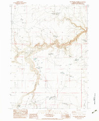
1982 Map of No Crossing Crossing
USGS Topo · Published 1983About this map
Big Antelope Basin and the surrounding high desert of Malheur County define this landscape, where water management is the primary marker of human activity. The 1979 field survey reveals a network of livestock infrastructure and small-scale earthen engineering, from the Twin Springs Corral in the north to the Sacramento area in the south. The nomenclature of the reservoirs — such as Doubtful Reservoir, Dubious Reservoir, Optimism Reservoir, and Desperation Reservoir — provides a vivid narrative of the challenges faced by ranchers in this arid terrain. Drainage patterns are dominated by Antelope Creek and its tributary Big Antelope Creek, which have carved significant features like the Twin Springs Gorge. Notable landmarks such as Deadman Butte and Emmets Hole serve as traditional navigational points in a region otherwise characterized by isolated corrals and remote basin floors.
Find a feature on this map
30 named features on this map. Tap any name to fly to it.
Don’t see what you’re looking for? This feature index may not catch every label — zoom into the map to look around manually.
Map Details
Editions of this 1982 No Crossing Crossing Map
This is the sole edition of this map. No revisions or reprints were ever made.
Other maps of this area

1955 · Jordan Valley
USGS Topo · 1:250,000

1957 · Jordan Valley
USGS Topo · 1:250,000

1958 · Jordan Valley
USGS Topo · 1:250,000

1980 · Three Forks
USGS Topo · 1:24,000
1980 · Caviatta Ridge
USGS Topo · 1:24,000
1980 · Squaw Flat
USGS Topo · 1:24,000
1982 · Rawhide Pocket
USGS Topo · 1:24,000
1982 · Starvation Spring
USGS Topo · 1:24,000
1982 · Peacock Lake
USGS Topo · 1:24,000
1982 · Rawhide Springs
USGS Topo · 1:24,000