
1973 Map of Cliffs
USGS Topo · Published 1977About this map
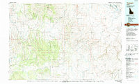
South Mountain anchors the high terrain of Owyhee County, where a legacy of hard-rock mining is etched into the landscape. This 1970s record shows a concentration of workings near the peak, including the Sonneman Mine, Golconda Mine, Laxey Mine, and the Texas Mine. A Lookout Tower marks the summit, overlooking a complex network of canyons and gulches. To the south, the small settlement of Cliffs sits near the Cliffs Landing Strip, indicating the reliance on aerial access in this remote corner of Idaho. Water management for mining or ranching is evident through features like Whitby Res and Anderson Res, while family names appear on landmarks such as Gertrudes Meadow and Dougherty Springs. The map also traces a long Aqueduct and numerous Jeep Trails that connect the high mines to the drainage of Cherry Creek and Lone Tree Creek.
Find a feature on this map
46 named features on this map. Tap any name to fly to it.
Don’t see what you’re looking for? This feature index may not catch every label — zoom into the map to look around manually.
Map Details
Editions of this 1973 Cliffs Map
This is the sole edition of this map. No revisions or reprints were ever made.
Other maps of this area

1955 · Jordan Valley
USGS Topo · 1:250,000

1957 · Jordan Valley
USGS Topo · 1:250,000

1958 · Jordan Valley
USGS Topo · 1:250,000

1965 · Flint Creek
USGS Topo · 1:62,500

1973 · Indian Meadows
USGS Topo · 1:24,000

1973 · Pleasant Valley
USGS Topo · 1:24,000

1973 · Fairylawn
USGS Topo · 1:24,000

1980 · Brewster Reservoir
USGS Topo · 1:24,000

1980 · Juniper Point
USGS Topo · 1:24,000
1990 · Triangle
USGS Topo · 1:100,000