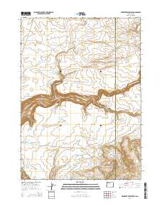
2014 Map of Brewster Reservoir
USGS Topo · Published 2014About this map
North Fork Owyhee River cuts a deep path across this remote high-desert landscape on the border of Malheur County and Owyhee County. This 2014 survey reveals an extensive network of water management features designed for ranching and resource use in an arid environment, notably the Brewster Reservoir, Brewster Reservoir Number Two, and several smaller catchments like Little Groundhog Reservoir and Mule Lake Reservoir. To the south, Soldier Meadows serves as a central landmark along Soldier Meadows Cr, near the winding Fenwick Ranch Rd. The topography is defined by dramatic breaks and canyons, including Little Box Canyon and the Pole Creek Breaks, which underscore the isolation of the Oregon-Idaho state line. Remote springs such as Dutcher Spring further highlight the essential water sources that have supported local land use for generations.
Find a feature on this map
29 named features on this map. Tap any name to fly to it.
Don’t see what you’re looking for? This feature index may not catch every label — zoom into the map to look around manually.
Map Details
Editions of this 2014 Brewster Reservoir Map
This is the sole edition of this map. No revisions or reprints were ever made.
Other maps of this area

1955 · Jordan Valley
USGS Topo · 1:250,000

1957 · Jordan Valley
USGS Topo · 1:250,000

1958 · Jordan Valley
USGS Topo · 1:250,000

1973 · Bedstead Ridge
USGS Topo · 1:24,000

1973 · Fairylawn
USGS Topo · 1:24,000

1973 · Cliffs
USGS Topo · 1:24,000

1980 · Brewster Reservoir
USGS Topo · 1:24,000

1980 · Three Forks
USGS Topo · 1:24,000

1980 · Juniper Point
USGS Topo · 1:24,000
1980 · Whitehorse Butte
USGS Topo · 1:24,000