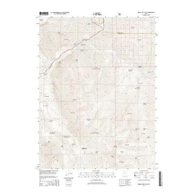
2014 Map of Bridal Veil Falls
USGS Topo · Published 2014About this map
Bridal Veil Falls and the surrounding peaks of the Wasatch Range dominate this 2014 survey of the mountain corridor northeast of Provo. The geography is defined by sharp elevation changes, from the Big Provo Cirque and the Timpanogos Glacier in the northwest to the high summits of Cascade Mtn and Freedom Peak. The Provo River cuts through the canyon, paralleled by US Hwy 189 and the Alpine Scenic Hwy, illustrating the modern transportation network that provides access to this portion of the Uinta National Forest. Recreation and infrastructure are central to this landscape, as seen in the Mountain Range Campground, the Bridal Veil Falls Sky Ride, and the Union Aqueduct. Further south, the map captures the transition toward the city near Y Mtn, while interior canyons like Shingle Mill Canyon and Rock Canyon reveal the complex drainage systems of the Wasatch front.
Find a feature on this map
94 named features on this map. Tap any name to fly to it.
Don’t see what you’re looking for? This feature index may not catch every label — zoom into the map to look around manually.
Map Details
Editions of this 2014 Bridal Veil Falls Map
This is the sole edition of this map. No revisions or reprints were ever made.
Other maps of this area

1885 · Salt Lake
USGS Topo · 1:250,000

1907 · Strawberry Valley
USGS Topo · 1:125,000

1909 · Strawberry Valley
USGS Topo · 1:125,000

1948 · Timpanogos Cave
USGS Topo · 1:24,000

1948 · Orem
USGS Topo · 1:24,000

1948 · Orem
USGS Topo · 1:62,500

1948 · Springville
USGS Topo · 1:24,000

1948 · Aspen Grove
USGS Topo · 1:24,000

1948 · Provo
USGS Topo · 1:24,000

1948 · Bridal Veil Falls
USGS Topo · 1:24,000