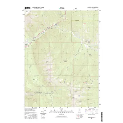
2017 Map of Bridal Veil Falls
USGS Topo · Published 2017About this map
The Provo River cuts a deep path through the Wasatch Range on this 2017 survey, defining the area's geography and settlement pattern. Small communities such as Wildwood, Vivian Park, and Springdell follow the canyon floor along Provo Canyon Rd, while the Uinta National Forest encompasses the surrounding high-elevation peaks. The map details the intricate drainage systems and canyons that feed into the main waterway, including Shingle Mill Canyon and Pole Canyon. Infrastructure for water and recreation is prominent, with the Provo River Parkway running parallel to the river and the Alta Aqueduct and Union Aqueduct marking the engineering efforts to manage local resources. Notable landmarks like the Bridal Veil Falls and Cascade Mtn illustrate the dramatic vertical relief that characterizes this section of Utah County.
Find a feature on this map
69 named features on this map. Tap any name to fly to it.
Don’t see what you’re looking for? This feature index may not catch every label — zoom into the map to look around manually.
Map Details
Editions of this 2017 Bridal Veil Falls Map
This is the sole edition of this map. No revisions or reprints were ever made.
Other maps of this area

1885 · Salt Lake
USGS Topo · 1:250,000

1907 · Strawberry Valley
USGS Topo · 1:125,000

1909 · Strawberry Valley
USGS Topo · 1:125,000

1948 · Timpanogos Cave
USGS Topo · 1:24,000

1948 · Orem
USGS Topo · 1:24,000

1948 · Orem
USGS Topo · 1:62,500

1948 · Springville
USGS Topo · 1:24,000

1948 · Aspen Grove
USGS Topo · 1:24,000

1948 · Provo
USGS Topo · 1:24,000

1948 · Bridal Veil Falls
USGS Topo · 1:24,000