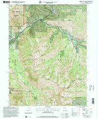
1998 Map of Bridal Veil Falls
USGS Topo · Published 2000About this map
Provo River carves a deep path through this 1990s Utah landscape, framed by the heights of Cascade Mountain and the southern slopes of Mount Timpanogos Wilderness. The canyon floor serves as a vital corridor for both natural and man-made infrastructure, containing the Salt Lake City Aqueduct and the Alpine Scenic Highway. Small canyon settlements like Wildwood, Vivian Park, and Springdell dot the riverbanks, alongside recreational landmarks including Sundance Ski Area and Trefoil Ranch.
Find a feature on this map
67 named features on this map. Tap any name to fly to it.
Don’t see what you’re looking for? This feature index may not catch every label — zoom into the map to look around manually.
Map Details
Editions of this 1998 Bridal Veil Falls Map
This is the sole edition of this map. No revisions or reprints were ever made.
Other maps of this area

1885 · Salt Lake
USGS Topo · 1:250,000

1907 · Strawberry Valley
USGS Topo · 1:125,000

1909 · Strawberry Valley
USGS Topo · 1:125,000

1948 · Timpanogos Cave
USGS Topo · 1:24,000

1948 · Orem
USGS Topo · 1:24,000

1948 · Orem
USGS Topo · 1:62,500

1948 · Springville
USGS Topo · 1:24,000

1948 · Aspen Grove
USGS Topo · 1:24,000

1948 · Provo
USGS Topo · 1:24,000

1948 · Bridal Veil Falls
USGS Topo · 1:24,000