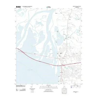
2011 Map of Bridgehead
USGS Topo · Published 2011About this map
Fort McDermott and the surrounding fortifications at Spanish Fort dominate the eastern bluffs overlooking the vast river delta at the head of Mobile Bay. This landscape is defined by the complex transition from the uplands of Saluda Ridge to the intricate network of the Tensaw River, Apalachee River, and Blakeley River. In the early 21st century, residential expansion is evident in the development of Lake Forest and Park City, while the northern reaches maintain a connection to their past through sites like the Blakeley Cemetery and Saluda Hill Cemetery. The Cochrane Bridge serves as a critical transportation artery, spanning the delta where the Raft River and Big Bay John meet. This geography highlights the strategic importance of the high ground above the marshes, where landings such as Buzbee Landing and Live Oak Landing provide access to the river-and-bay economy.
Find a feature on this map
107 named features on this map. Tap any name to fly to it.
Don’t see what you’re looking for? This feature index may not catch every label — zoom into the map to look around manually.
Map Details
Editions of this 2011 Bridgehead Map
This is the sole edition of this map. No revisions or reprints were ever made.
Other maps of this area

1921 · Fairhope
USGS Topo · 1:62,500

1922 · Mobile
USGS Topo · 1:62,500

1939 · Daphne
USGS Topo · 1:31,680

1940 · Silverhill
USGS Topo · 1:31,680

1940 · Hollingers Island
USGS Topo · 1:31,680

1940 · Mobile
USGS Topo · 1:31,680

1940 · Mobile
USGS Topo · 1:62,500

1941 · Chickasaw
USGS Topo · 1:31,680

1941 · Daphne
USGS Topo · 1:31,680

1941 · Silverhill
USGS Topo · 1:31,680