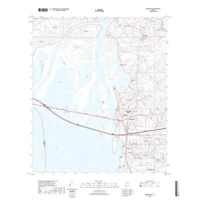
2018 Map of Bridgehead
USGS Topo · Published 2018About this map
Spanish Fort and the neighboring community of Bridgehead occupy the high ground overlooking the complex delta where the Tensaw River, Apalachee River, and Blakeley River converge. This 2018 survey documents a landscape defined by its strategic military and maritime geography, preserved in landmarks like Fort McDermott and the Alabama State Veterans Memorial Cem at Spanish Fort. The western half of the map is dominated by a sprawling network of marshlands, islands such as Runamuck Island and Big Island, and numerous water bodies including Chacaloochee Bay and Big Bateau Bay. Transport networks bridge this aquatic divide, most notably via the Cochrane Bridge and Battleship Pkwy, connecting the residential developments of Park City and Saluda Ridge to the wider coastal region. Local history is further anchored by old burial grounds like Blakeley Cem and Saluda Hill Cem.
Find a feature on this map
140 named features on this map. Tap any name to fly to it.
Don’t see what you’re looking for? This feature index may not catch every label — zoom into the map to look around manually.
Map Details
Editions of this 2018 Bridgehead Map
This is the sole edition of this map. No revisions or reprints were ever made.
Other maps of this area

1921 · Fairhope
USGS Topo · 1:62,500

1922 · Mobile
USGS Topo · 1:62,500

1939 · Daphne
USGS Topo · 1:31,680

1940 · Silverhill
USGS Topo · 1:31,680

1940 · Hollingers Island
USGS Topo · 1:31,680

1940 · Mobile
USGS Topo · 1:31,680

1940 · Mobile
USGS Topo · 1:62,500

1941 · Chickasaw
USGS Topo · 1:31,680

1941 · Daphne
USGS Topo · 1:31,680

1941 · Silverhill
USGS Topo · 1:31,680