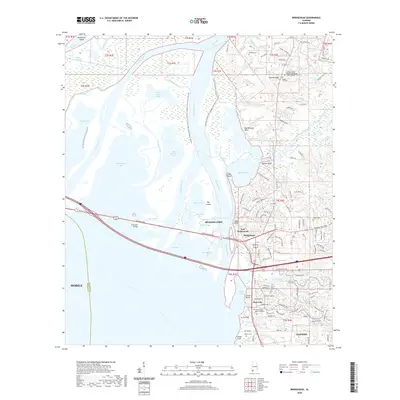
2020 Map of Bridgehead
USGS Topo · Published 2020About this map
Fort McDermott stands as a focal point of this coastal landscape, situated near the historical settlement of Spanish Fort. The map details the complex estuarine environment where the Tensaw River, Apalachee River, and Blakeley River converge before emptying into Bay Minette. This intricate network of waterways is navigated via the Bartram Canoe Trail, which threads through islands and bays like Chacaloochee Bay and Big Island. On the eastern shore, the transition from marshland to established communities is evident in the development of Bridgehead, Park City, and the northern reaches of Daphne. Genealogists and local historians will find value in the documented locations of the Blakeley Cem, D'Olive Cem, and the Cem at Spanish Fort, all situated along the ridges overlooking the delta.
Find a feature on this map
185 named features on this map. Tap any name to fly to it.
Don’t see what you’re looking for? This feature index may not catch every label — zoom into the map to look around manually.
Map Details
Editions of this 2020 Bridgehead Map
This is the sole edition of this map. No revisions or reprints were ever made.
Other maps of this area

1921 · Fairhope
USGS Topo · 1:62,500

1922 · Mobile
USGS Topo · 1:62,500

1939 · Daphne
USGS Topo · 1:31,680

1940 · Silverhill
USGS Topo · 1:31,680

1940 · Hollingers Island
USGS Topo · 1:31,680

1940 · Mobile
USGS Topo · 1:31,680

1940 · Mobile
USGS Topo · 1:62,500

1941 · Chickasaw
USGS Topo · 1:31,680

1941 · Daphne
USGS Topo · 1:31,680

1941 · Silverhill
USGS Topo · 1:31,680