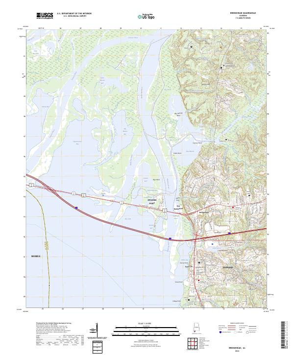
2024 Map of Bridgehead
USGS Topo · Published 2024About this map
Spanish Fort and Bridgehead occupy the high ground overlooking the complex delta where the Tensaw River and Apalachee River meet D'Olive Bay. This modern survey reveals a landscape of transition, from the dense residential developments of Daphne and the Lake Forest area to the preserved wilderness of the Bartram Canoe Trail system, including the route from Berkeley Park Ramp to Mudhole Campsite.
Find a feature on this map
98 named features on this map. Tap any name to fly to it.
Don’t see what you’re looking for? This feature index may not catch every label — zoom into the map to look around manually.
Map Details
Editions of this 2024 Bridgehead Map
This is the sole edition of this map. No revisions or reprints were ever made.
Other maps of this area

1921 · Fairhope
USGS Topo · 1:62,500

1922 · Mobile
USGS Topo · 1:62,500

1939 · Daphne
USGS Topo · 1:31,680

1940 · Silverhill
USGS Topo · 1:31,680

1940 · Hollingers Island
USGS Topo · 1:31,680

1940 · Mobile
USGS Topo · 1:31,680

1940 · Mobile
USGS Topo · 1:62,500

1941 · Chickasaw
USGS Topo · 1:31,680

1941 · Daphne
USGS Topo · 1:31,680

1941 · Silverhill
USGS Topo · 1:31,680