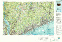
1986 Map of Bridgeport
USGS Topo · Published 1988About this map
The Long Island Sound coastline and the lower Hudson River valley anchor this mid-1980s survey of the tri-state region. The landscape is defined by the dense suburbanization and industrial hubs of Fairfield and Westchester counties, connected by the Metro-North Railroad and Conrail lines. Significant landmarks such as the West Point Military Academy and Sing Sing Prison sit along the Hudson, while the interior is marked by an extensive reservoir system, including the New Croton Reservoir and West Branch Reservoir, which illustrates the critical water infrastructure serving the greater New York metropolitan area. To the north, Danbury serves as a focal point near Candlewood Lake, while the Connecticut shoreline transitions from the financial center of Stamford to the manufacturing and maritime heritage of Bridgeport. The map also captures preserved green spaces like Bear Mountain State Park and Ward Pound Ridge Reservation amidst the expanding road networks of Interstate 95 and the Merritt Parkway.
Find a feature on this map
739 named features on this map. Tap any name to fly to it.
Don’t see what you’re looking for? This feature index may not catch every label — zoom into the map to look around manually.
Map Details
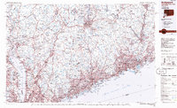
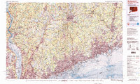
Editions of this 1986 Bridgeport Map
3 editions found
Other maps of this area

1888 · Paterson
USGS Topo · 1:62,500

1889 · Derby
USGS Topo · 1:62,500

1891 · Ramapo
USGS Topo · 1:62,500

1891 · Harlem
USGS Topo · 1:62,500

1891 · Bridgeport
USGS Topo · 1:62,500

1891 · Derby
USGS Topo · 1:62,500

1892 · Stamford
USGS Topo · 1:62,500

1892 · West Point
USGS Topo · 1:62,500

1892 · New Haven
USGS Topo · 1:62,500

1892 · Danbury
USGS Topo · 1:62,500