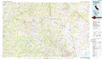
1985 Map of Bridgeport
USGS Topo · Published 1985About this map
Bridgeport serves as the focal point of this high-elevation landscape, situated at the junction of the East Walker River and the Bridgeport Reservoir. The map illustrates a complex intersection of public lands, where the Stanislaus National Forest, Toiyabe National Forest, and Yosemite National Park converge. This 1985 revision highlights the region's enduring mining legacy, particularly in the Bodie Hills and surrounding peaks, where numerous sites such as the Bodie Mine, Chemung Mine, and Masonic Mine are identified.
Find a feature on this map
65 named features on this map. Tap any name to fly to it.
Don’t see what you’re looking for? This feature index may not catch every label — zoom into the map to look around manually.
Map Details
Editions of this 1985 Bridgeport Map
This is the sole edition of this map. No revisions or reprints were ever made.
Other maps of this area

1889 · Pyramid Peak
USGS Topo · 1:125,000

1889 · Markleeville
USGS Topo · 1:125,000

1891 · Markleeville
USGS Topo · 1:125,000

1891 · Big Trees
USGS Topo · 1:125,000

1891 · Pyramid Peak
USGS Topo · 1:125,000

1891 · Wellington
USGS Topo · 1:125,000

1893 · Markleeville
USGS Topo · 1:125,000

1893 · Sonora
USGS Topo · 1:125,000

1893 · Wellington
USGS Topo · 1:125,000

1894 · Big Trees
USGS Topo · 1:125,000