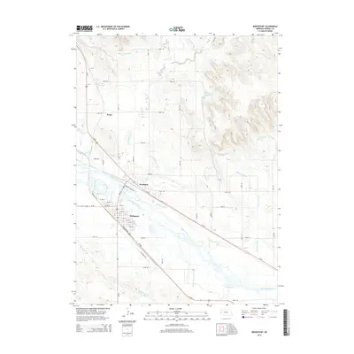
2014 Map of Bridgeport
USGS Topo · Published 2014About this map
The North Platte River valley defines the character of this region, where a complex irrigation system supports the agricultural plains of the Nebraska Panhandle. The settlement of Bridgeport stands at the heart of this network, positioned near the confluence where Pumpkin Cr approaches the main river channel. Water management is a dominant theme of the landscape, evidenced by the extensive reach of the Belmont Canal, the Browns Creek Canal, and smaller features like the Silvernail Drain. These engineering works, including the Meredith Ammer Canal, illustrate the long-standing efforts to reclaim and cultivate this arid terrain.
Find a feature on this map
54 named features on this map. Tap any name to fly to it.
Don’t see what you’re looking for? This feature index may not catch every label — zoom into the map to look around manually.
Map Details
Editions of this 2014 Bridgeport Map
This is the sole edition of this map. No revisions or reprints were ever made.
Other maps of this area

1896 · Browns Creek
USGS Topo · 1:125,000

1898 · Camp Clarke
USGS Topo · 1:125,000

1899 · Browns Creek
USGS Topo · 1:125,000

1949 · Lynn
USGS Topo · 1:62,500

1954 · Scottsbluff
USGS Topo · 1:250,000

1958 · Scottsbluff
USGS Topo · 1:250,000

1965 · Bridgeport NW
USGS Topo · 1:24,000

1965 · Angora SE
USGS Topo · 1:24,000

1965 · Courthouse Rock
USGS Topo · 1:24,000

1965 · Broadwater NW
USGS Topo · 1:24,000