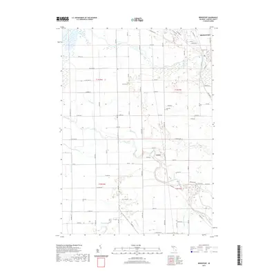
2019 Map of Bridgeport
USGS Topo · Published 2019About this map
Bridgeport and the surrounding township are defined by the convergence of several significant watercourses, most notably the Cass River and the Flint River. This survey illustrates a landscape deeply shaped by agricultural drainage and river networks, where the Birch Run and Misteguay Cr flow through a grid of rural roads and established cemeteries. Local history is anchored by sites such as Oak Grove Cem and Spaulding Cem, which sit alongside historic transit corridors like the Dixie Hwy. The smaller settlement of Fosters sits further south along the river, marking a distinct pocket of development. The intricate network of man-made channels, including Bortle Drain and Peart Drain, demonstrates the long-term engineering required to manage the flat terrain for regional farming.
Find a feature on this map
84 named features on this map. Tap any name to fly to it.
Don’t see what you’re looking for? This feature index may not catch every label — zoom into the map to look around manually.
Map Details
Editions of this 2019 Bridgeport Map
This is the sole edition of this map. No revisions or reprints were ever made.
Other maps of this area

1917 · Chesaning
USGS Topo · 1:62,500

1917 · St. Charles
USGS Topo · 1:62,500

1919 · Saginaw
USGS Topo · 1:62,500

1919 · Burt
USGS Topo · 1:62,500

1921 · Burt
USGS Topo · 1:62,500

1941 · Saginaw
USGS Topo · 1:62,500

1943 · Burt
USGS Topo · 1:62,500

1943 · Chesaning
USGS Topo · 1:62,500

1943 · Saginaw
USGS Topo · 1:62,500

1943 · St. Charles
USGS Topo · 1:62,500
Featured Places
- Bridgeport Charter Township, MI
- Albee Township, MI
- Taymouth Township, MI
- James Township, MI
- Spaulding Township, MI