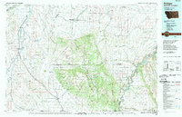
1989 Map of Bridger
USGS Topo · Published 1989About this map
Clarks Fork Yellowstone River and the Burlington Northern railroad define the western valley of this landscape, connecting the agricultural hubs of Bridger, Fromberg, and Joliet. The map reveals a dramatic transition from the irrigated bottomlands of the Yellowstone River system to the high, varied terrain of the Pryor Mountains. A significant portion of the sheet is occupied by the Crow Indian Reservation, which includes the Chief Plenty Coups Memorial State Mon at Pryor. To the southeast, the geography is shaped by the steep descent into Bighorn Canyon, where the Bighorn River flows through the Bighorn Canyon National Recreation Area. This late-twentieth-century survey documents a region where mountain forests and tribal lands meet the settled ranching corridors of the Carbon and Big Horn county lines.
Find a feature on this map
43 named features on this map. Tap any name to fly to it.
Don’t see what you’re looking for? This feature index may not catch every label — zoom into the map to look around manually.
Map Details
Editions of this 1989 Bridger Map
This is the sole edition of this map. No revisions or reprints were ever made.
Other maps of this area

1892 · Stillwater
USGS Topo · 1:125,000

1893 · Huntley
USGS Topo · 1:125,000

1894 · St. Xavier
USGS Topo · 1:125,000

1894 · Fort Custer
USGS Topo · 1:125,000

1898 · Bald Mountain
USGS Topo · 1:125,000

1901 · St. Xavier
USGS Topo · 1:125,000

1901 · Bald Mountain
USGS Topo · 1:125,000

1915 · Spenceville
USGS Topo · 1:31,680

1932 · Red Lodge No 1
USGS Topo · 1:48,000

1944 · Red Lodge
USGS Topo · 1:62,500