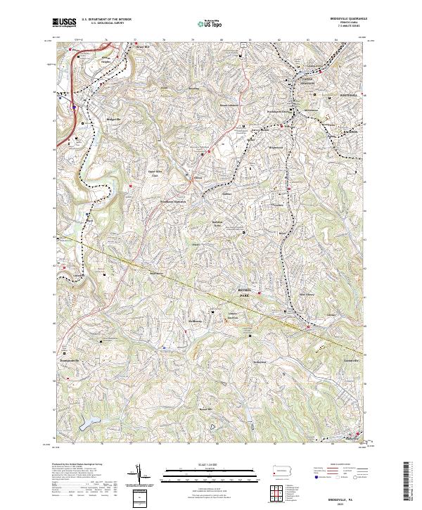
2023 Map of Bridgeville
USGS Topo · Published 2023About this map
Bridgeville and the southern suburbs of Pittsburgh are captured here as they straddle the Allegheny and Washington County line. The landscape is defined by the winding course of Chartiers Creek and its many tributaries, including McLaughlin Run and Painters Run, which have historically shaped the development of neighborhoods like Upper Saint Clair and Mount Lebanon. The map detail shows a dense concentration of civic and religious landmarks, particularly cemeteries such as Saint Anne Cem and Queen of Heaven Cem, which serve as significant sites for local genealogical research.
Find a feature on this map
90 named features on this map. Tap any name to fly to it.
Don’t see what you’re looking for? This feature index may not catch every label — zoom into the map to look around manually.
Map Details
Editions of this 2023 Bridgeville Map
This is the sole edition of this map. No revisions or reprints were ever made.
Historical Maps of Turkeyfoot Through Time
4 maps found