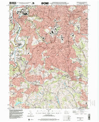
1993 Map of Bridgeville
USGS Topo · Published 1999About this map
Suburban expansion and coal-country history intersect in this 1993 study of the south hills of Pittsburgh. Mount Lebanon, Bethel Park, and Castle Shannon display a dense network of residential streets and parochial institutions such as St Francis Academy and the Immaculate Heart of Mary Seminary. The map illustrates a landscape in transition, where the legacy of heavy industry is still visible in Mine Dump sites and Anne Siding, while modern infrastructure like Interchange 12 and Interchange 13 serves a growing commuter population. Local landmarks like the Radio Range Station and Mount Lebanon Municipal Golf Course provide spatial anchors for the sprawling subdivisions of Broadlawn Highlands and Ruthfred Acres. Further south in Peters and North Strabane, the terrain remains more open, featuring Lehner Lakes and the sprawling Queen of Heaven Cemetery.
Find a feature on this map
97 named features on this map. Tap any name to fly to it.
Don’t see what you’re looking for? This feature index may not catch every label — zoom into the map to look around manually.
Map Details
Editions of this 1993 Bridgeville Map
This is the sole edition of this map. No revisions or reprints were ever made.
Other maps of this area

1901 · Amity
USGS Topo · 1:62,500

1902 · Brownsville
USGS Topo · 1:62,500

1904 · Amity
USGS Topo · 1:62,500

1904 · Mc Keesport
USGS Topo · 1:62,500

1904 · Carnegie
USGS Topo · 1:62,500

1906 · Brownsville
USGS Topo · 1:62,500

1906 · Carnegie
USGS Topo · 1:62,500

1907 · Pittsburg
USGS Topo · 1:62,500

1908 · Carnegie
USGS Topo · 1:62,500

1931 · Brownsville
USGS Topo · 1:62,500