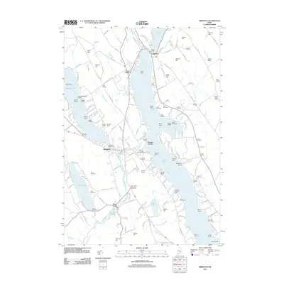
2011 Map of Bridgton
USGS Topo · Published 2011About this map
Bridgton and Harrison anchor this lakeside landscape in Cumberland County, where the historic settlement patterns of western Maine are defined by a network of waterways and early industrial sites. The importance of local water power is evident in the numerous control points found along the drainage systems, including the Crystal Lake Dam, Highland Lake Dam, and Stevens Brook Dam. These sites supported the growth of villages like North Bridgton and Plummer Landing, while Sandy Creek developed around its own milling infrastructure.
Find a feature on this map
172 named features on this map. Tap any name to fly to it.
Don’t see what you’re looking for? This feature index may not catch every label — zoom into the map to look around manually.
Map Details
Editions of this 2011 Bridgton Map
This is the sole edition of this map. No revisions or reprints were ever made.
Other maps of this area

1896 · Norway
USGS Topo · 1:62,500

1896 · Sebago
USGS Topo · 1:62,500

1909 · Fryeburg
USGS Topo · 1:62,500

1910 · Kezar Falls
USGS Topo · 1:48,000

1911 · Fryeburg
USGS Topo · 1:62,500

1911 · Kezar Falls
USGS Topo · 1:62,500

1941 · Fryeburg
USGS Topo · 1:62,500

1942 · Sebago Lake
USGS Topo · 1:62,500

1943 · Sebago Lake
USGS Topo · 1:62,500

1946 · Norway
USGS Topo · 1:62,500