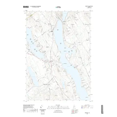
2021 Map of Bridgton
USGS Topo · Published 2021About this map
Long Lake and Highland Lake dominate this landscape in the Lakes Region, where the village of Bridgton serves as a central hub between these large water bodies. The terrain is defined by a series of prominent rises including Whitney Hill, Town Farm Hill, and Maple Ridge, the latter of which features the small Maple Ridge Airport. Waterways like Stevens Brook and Willett Brook connect the ponds and lakes, tracing a path through the valley floor.
Find a feature on this map
178 named features on this map. Tap any name to fly to it.
Don’t see what you’re looking for? This feature index may not catch every label — zoom into the map to look around manually.
Map Details
Editions of this 2021 Bridgton Map
This is the sole edition of this map. No revisions or reprints were ever made.
Other maps of this area

1896 · Norway
USGS Topo · 1:62,500

1896 · Sebago
USGS Topo · 1:62,500

1909 · Fryeburg
USGS Topo · 1:62,500

1910 · Kezar Falls
USGS Topo · 1:48,000

1911 · Fryeburg
USGS Topo · 1:62,500

1911 · Kezar Falls
USGS Topo · 1:62,500

1941 · Fryeburg
USGS Topo · 1:62,500

1942 · Sebago Lake
USGS Topo · 1:62,500

1943 · Sebago Lake
USGS Topo · 1:62,500

1946 · Norway
USGS Topo · 1:62,500