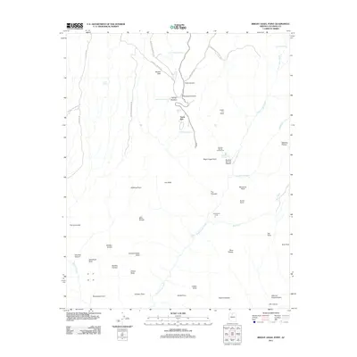
2011 Map of Bright Angel Point
USGS Topo · Published 2011About this map
North Rim serves as the primary settlement and gateway within this high-elevation landscape, where the plateau gives way to the deep, intricate drainages of the Grand Canyon National Park. The topography is defined by massive formations named for global religious architecture, such as Manu Temple, Brahma Temple, and the Buddha Temple. These monuments overlook a complex network of water features and canyons, including the significant descent of Bright Angel Creek and the notable Ribbon Falls.
Find a feature on this map
50 named features on this map. Tap any name to fly to it.
Don’t see what you’re looking for? This feature index may not catch every label — zoom into the map to look around manually.
Map Details
Editions of this 2011 Bright Angel Point Map
This is the sole edition of this map. No revisions or reprints were ever made.
Other maps of this area

1886 · Echo Cliffs
USGS Topo · 1:250,000

1886 · Kaibab
USGS Topo · 1:250,000

1891 · Echo Cliffs
USGS Topo · 1:250,000

1903 · Bright Angel
USGS Topo · 1:48,000

1906 · Bright Angel
USGS Topo · 1:48,000

1907 · Vishnu
USGS Topo · 1:48,000

1953 · Grand Canyon
USGS Topo · 1:250,000

1954 · Nankoweap
USGS Topo · 1:62,500

1956 · Marble Canyon
USGS Topo · 1:250,000

1957 · Grand Canyon
USGS Topo · 1:250,000