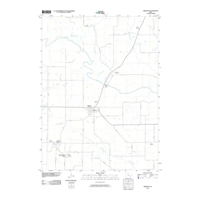
2010 Map of Brighton
USGS Topo · Published 2010About this map
The Skunk River meanders through the heart of this Washington County landscape, defining the character of the river bottomlands north of Brighton. This area preserves several distinct clusters of early settlement and religious heritage, particularly around the Quaker roots of Pleasant Plain and the nearby East Pleasant Plain. The map provides a remarkable record for genealogists, documenting numerous local burial grounds including Friends Cemetery, Saint Josephs Cemetery, and Sandy Hook Cemetery.
Find a feature on this map
47 named features on this map. Tap any name to fly to it.
Don’t see what you’re looking for? This feature index may not catch every label — zoom into the map to look around manually.
Map Details
Editions of this 2010 Brighton Map
This is the sole edition of this map. No revisions or reprints were ever made.
Other maps of this area

1958 · Davenport
USGS Topo · 1:250,000

1961 · Davenport
USGS Topo · 1:250,000

1962 · Davenport
USGS Topo · 1:250,000

1969 · Washington
USGS Topo · 1:24,000
1973 · Keota
USGS Topo · 1:24,000

1973 · West Chester
USGS Topo · 1:24,000
1980 · Fairfield North
USGS Topo · 1:24,000
1980 · Richland
USGS Topo · 1:24,000

1980 · Brighton
USGS Topo · 1:24,000

1980 · Trenton
USGS Topo · 1:24,000