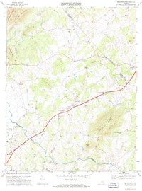
1971 Map of Brightwood
USGS Topo · Published 1972About this map
Brightwood serves as a central hub in this Virginia Piedmont landscape, where the primary roadway corridor connects small settlements like Leon, Madison Wayside, and Zeus. The terrain is defined by the winding course of the Robinson River and its numerous tributaries, including Devils Run, Crooked Run, and White Oak Run. This 1971 survey reveals a deeply rooted rural community, evidenced by a high density of country churches such as Bethsaida Ch, Chestnut Grove Ch, and the Robinson River Ch. These spiritual centers, often paired with small family or community cemeteries, indicate long-established landholdings and genealogical hubs. To the west and south, the elevation rises toward landmarks like Thorofare Mountain and Aylor Mountain, while a prominent Pipeline cuts across the drainage basins of Muddy Run and Deep Run, marking a modern industrial layer over the traditional agricultural patterns of the Culpeper and Madison County borderlands.
Find a feature on this map
34 named features on this map. Tap any name to fly to it.
Don’t see what you’re looking for? This feature index may not catch every label — zoom into the map to look around manually.
Map Details
Editions of this 1971 Brightwood Map
2 editions found
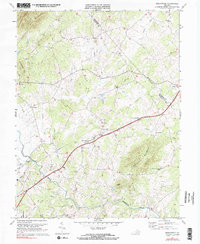
Other maps of this area

1892 · Gordonsville
USGS Topo · 1:125,000

1893 · Luray
USGS Topo · 1:125,000

1905 · Luray
USGS Topo · 1:125,000

1929 · Stony Man
USGS Topo · 1:48,000

1930 · Madison
USGS Topo · 1:48,000

1933 · Stony Man
USGS Topo · 1:62,500

1933 · Madison
USGS Topo · 1:62,500

1949 · Charlottesville
USGS Topo · 1:250,000

1956 · Charlottesville
USGS Topo · 1:250,000

1961 · Sperryville
USGS Topo · 1:62,500