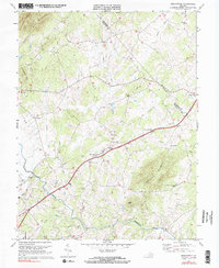
1971 Map of Brightwood
USGS Topo · Published 1983About this map
Robinson River winds through the heart of this Piedmont landscape, serving as a defining geographical feature for the dispersed rural communities of Madison and Culpeper Counties. The settlement pattern here is characterized by small crossroads and church-centered hamlets such as Brightwood, Leon, and Novum. Spiritual and social life is anchored by numerous historic congregations, including Hebron Ch, Bethsaida Ch, and Robinson River Ch, many of which are accompanied by small family or church cemeteries. The terrain transitions from the prominent heights of Thorofare Mountain and Hitt Mtn in the east and north down toward the river bottomlands. This 1971 revision captures the area before modern development, showing a network of secondary roads connecting established landmarks like the Madison Wayside and smaller locales such as Decapolis and Zeus.
Find a feature on this map
33 named features on this map. Tap any name to fly to it.
Don’t see what you’re looking for? This feature index may not catch every label — zoom into the map to look around manually.
Map Details
Editions of this 1971 Brightwood Map
2 editions found
Other maps of this area

1892 · Gordonsville
USGS Topo · 1:125,000

1893 · Luray
USGS Topo · 1:125,000

1905 · Luray
USGS Topo · 1:125,000

1929 · Stony Man
USGS Topo · 1:48,000

1930 · Madison
USGS Topo · 1:48,000

1933 · Stony Man
USGS Topo · 1:62,500

1933 · Madison
USGS Topo · 1:62,500

1949 · Charlottesville
USGS Topo · 1:250,000

1956 · Charlottesville
USGS Topo · 1:250,000

1961 · Sperryville
USGS Topo · 1:62,500