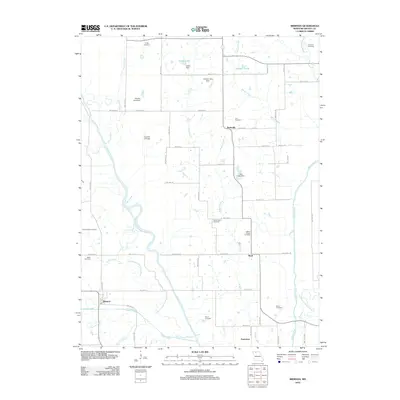
2012 Map of Brimson
USGS Topo · Published 2012About this map
Thompson River and Weldon River define the hydraulic character of this Grundy County landscape, where the meandering paths of their old channels suggest a history of natural shifts and flood management. The rural community of Brimson sits near the southwestern corner at the junction of Sugar Creek and Cattail Creek, while smaller settlements like Buttsville, Shott, and Parkerton anchor the surrounding agricultural grid.
Find a feature on this map
78 named features on this map. Tap any name to fly to it.
Don’t see what you’re looking for? This feature index may not catch every label — zoom into the map to look around manually.
Map Details
Editions of this 2012 Brimson Map
This is the sole edition of this map. No revisions or reprints were ever made.
Other maps of this area

1925 · Gilman
USGS Topo · 1:62,500

1946 · Gilman
USGS Topo · 1:48,000

1946 · Princeton
USGS Topo · 1:62,500

1947 · Blythedale
USGS Topo · 1:62,500

1948 · Gilman
USGS Topo · 1:62,500

1948 · Princeton
USGS Topo · 1:62,500

1948 · Trenton
USGS Topo · 1:62,500

1954 · Centerville
USGS Topo · 1:250,000

1957 · Centerville
USGS Topo · 1:250,000

1958 · Centerville
USGS Topo · 1:250,000