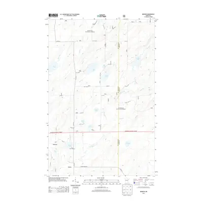
2013 Map of Brimson
USGS Topo · Published 2013About this map
Superior National Forest encompasses the vast majority of this landscape, where the headwaters of the Cloquet River and Langley River carve through a terrain defined by numerous glacial lakes. The small communities of Brimson and Rollins sit along Co HWY 44, representing the primary points of settlement in a region dominated by timber and conservation. Local history is anchored by sites such as the Brimson Cem and Toimi Cem, while the Indian Lake Campground suggests the area's long-standing role as a destination for outdoor recreation.
Find a feature on this map
56 named features on this map. Tap any name to fly to it.
Don’t see what you’re looking for? This feature index may not catch every label — zoom into the map to look around manually.
Map Details
Editions of this 2013 Brimson Map
This is the sole edition of this map. No revisions or reprints were ever made.
Other maps of this area

1953 · Whyte
USGS Topo · 1:62,500

1954 · Two Harbors
USGS Topo · 1:250,000

1956 · Pequaywan Lake
USGS Topo · 1:24,000

1956 · King Lake
USGS Topo · 1:24,000

1957 · Two Harbors
USGS Topo · 1:250,000

1957 · Two Harbors
USGS Topo · 1:62,500

1957 · Brimson
USGS Topo · 1:62,500

1958 · Two Harbors
USGS Topo · 1:250,000

1964 · Two Harbors
USGS Topo · 1:250,000
1976 · Brimson SW
USGS Topo · 1:24,000