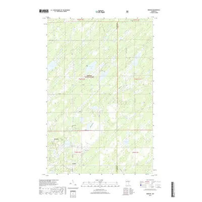
2019 Map of Brimson
USGS Topo · Published 2019About this map
The Superior National Forest defines the wooded and water-rich character of this section of northeastern Minnesota. The small settlements of Brimson and Rollins serve as the primary human touchpoints in a landscape dominated by the headwaters and drainage of the Cloquet River. This area, situated along the border of Saint Louis and Lake Counties, shows a complex network of glacial lakes including Wilson Lake, Breda Lake, and Norton Lake. The presence of the Brimson Cem and the Toimi Cem at the northern edge provides valuable location data for genealogists tracing early families in these timber-and-bog townships. Low-lying terrain is evident through the numerous wetlands and small streams like Petrell Cr and Indian Cr that feed into the larger river systems and scattered lakes.
Find a feature on this map
55 named features on this map. Tap any name to fly to it.
Don’t see what you’re looking for? This feature index may not catch every label — zoom into the map to look around manually.
Map Details
Editions of this 2019 Brimson Map
This is the sole edition of this map. No revisions or reprints were ever made.
Other maps of this area

1953 · Whyte
USGS Topo · 1:62,500

1954 · Two Harbors
USGS Topo · 1:250,000

1956 · Pequaywan Lake
USGS Topo · 1:24,000

1956 · King Lake
USGS Topo · 1:24,000

1957 · Two Harbors
USGS Topo · 1:250,000

1957 · Two Harbors
USGS Topo · 1:62,500

1957 · Brimson
USGS Topo · 1:62,500

1958 · Two Harbors
USGS Topo · 1:250,000

1964 · Two Harbors
USGS Topo · 1:250,000
1976 · Brimson SW
USGS Topo · 1:24,000