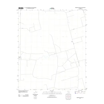
2012 Map of Brinson Ranch
USGS Topo · Published 2012About this map
Brinson Ranch anchors this high-plains landscape in Gaines County, Texas, serving as a primary point of reference in an area characterized by its wide, geometric road network and cattle country heritage. The terrain is bisected by the ephemeral path of Monument Draw, a significant hydrological feature that cuts westward across the quadrangle. This 2012 survey illustrates the methodical layout of the Llano Estacado, where local transit is defined by a grid of county roads such as Co Rd-331 and Co Rd-324. The sparse distribution of named structures and the prominence of the ranching namesake reflect the long-standing agricultural and land-use patterns of West Texas. Researchers of the region will find a clear record of the modern rural infrastructure, noting how these secondary routes like Co Rd-318 connect isolated homesteads and work sites to the broader Gaines County area.
Find a feature on this map
10 named features on this map. Tap any name to fly to it.
Don’t see what you’re looking for? This feature index may not catch every label — zoom into the map to look around manually.
Map Details
Editions of this 2012 Brinson Ranch Map
This is the sole edition of this map. No revisions or reprints were ever made.
Other maps of this area

1954 · Hobbs
USGS Topo · 1:250,000

1958 · Hobbs
USGS Topo · 1:250,000

1969 · Hobbs East
USGS Topo · 1:24,000

1969 · Hobbs SE
USGS Topo · 1:24,000

1969 · Eunice NE
USGS Topo · 1:24,000

1971 · Paynes Corner
USGS Topo · 1:24,000

1971 · Brinson Ranch
USGS Topo · 1:24,000

1971 · Paynes Corner SE
USGS Topo · 1:24,000

1971 · Frankel City
USGS Topo · 1:24,000

1971 · Jumbo Hill
USGS Topo · 1:24,000